Atlantic Climate Adaptation Solutions Workshops
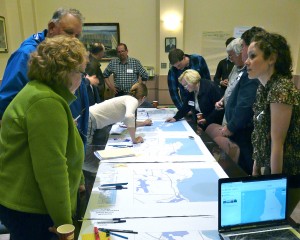
On June 14th at Town Hall and June 15th at the Municipal Building a team of students from Dalhousie met with local residents to begin mapping of assets that could be effected by the rise of sea level and weather events attributable to climate change. It was also disclosed that Nova Scotia is in a period on natural subsidence from long ago (10,000 years) glacial changes. So, if you are already seeing changes to the coast in your lifetime this could be a factor.
Okay. Climate change, habitat change, geographic change, is hard to grasp – we like things to stay the way they are. It is like growing old. It just takes place a little bit at time. For a quick understanding put a big pot of cold water on your stove and turn on the heat and stick your hand in the water. It will feel fine, even good for awhile. But, at some point …. you just won’t like it anymore.
These workshops were part of a research program carried out by the Dalhousie School of Planning, in cooperation with the Town of Yarmouth, Municipality of the District of Yarmouth, and TREPA.
The aim of the workshops was primarily to identify existing and potential impacts from sea level rise, storm surges, and related increased erosion, with the ultimate goal of identifying ways of making our community more resilient to climate change.
The gathering on June 14 included about seven representatives from the University, three TREPA Board members, John Sollows, TREPA Executive Director, and seven other area residents. A similar format and similar turnout followed the evening of June 15 at the Yarmouth Municipal building.
We were invited to discuss and map changes we have already seen and those we can predict from continued sea level rise. Damage to wharves and other coastal fishery, tourism, and commercial infrastructure, roads, and backup of the town sewer system were among the major effects predicted. The trip to the hospital may become considerably longer for most town residents. What effect could a one-meter rise have on Tusket Dam? Damage to historic sites and erosion of coastal farmland were also foreseen. Effects on aquifers and water supplies may have started already; it was noted that one well on Cape Forchu has already turned salt and some new drilled wells on the coast south of Port Maitland have a similar problem.
The mapping exercises and related discussion were a first step. The team plans to visit later in the summer, and possibly focus more on potential responses to sea level rise. Ultimately, it is hoped that this research will help the town and municipality develop plans to cope better with climate change.

